

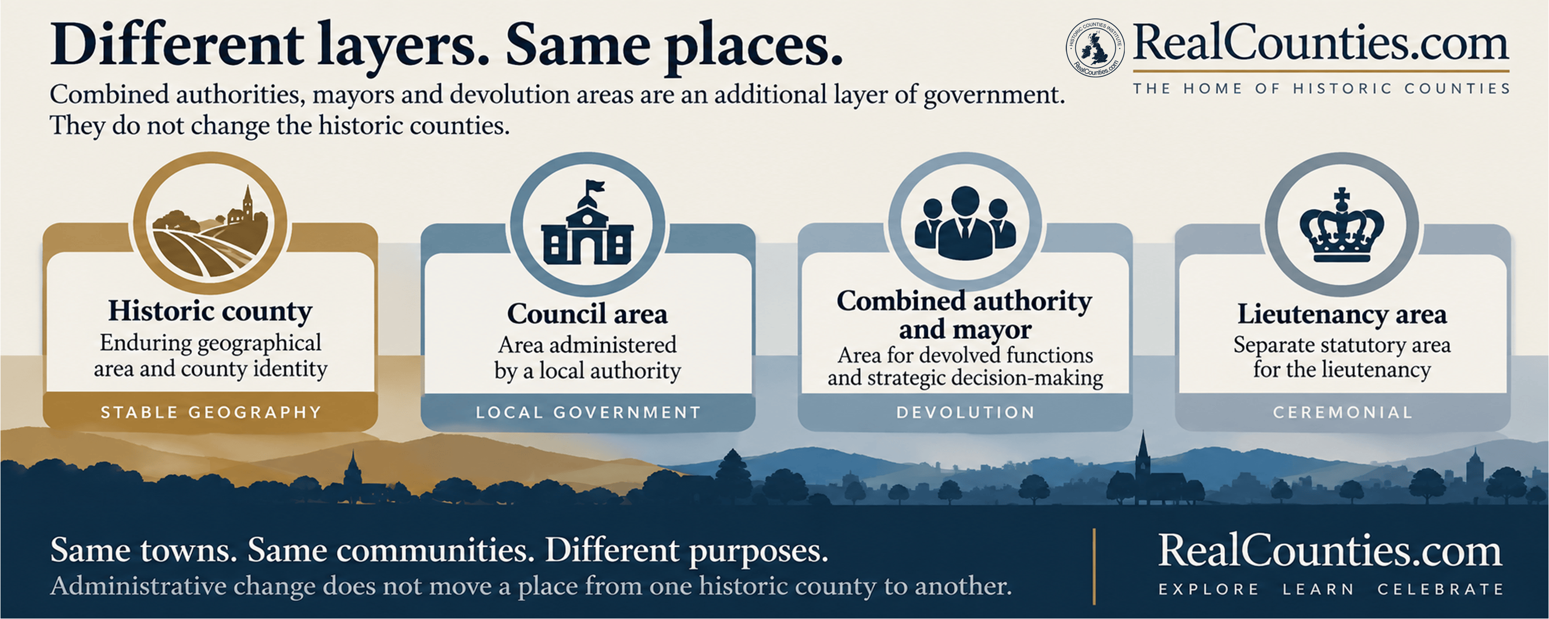
No. Combined authorities, strategic authorities, elected mayors and devolution areas are administrative structures. They do not create, abolish, merge, divide or redraw the historic counties.
They form a newer layer of government, designed to exercise particular powers across areas which may cover several local authorities. Their boundaries can coincide with historic county boundaries, cut across them or encompass parts of several historic counties. None of those arrangements determines which historic county a place belongs to.
That distinction has become especially important as English devolution has expanded. Names such as Greater Manchester, West Midlands and Cumbria are increasingly prominent in the language of mayors, investment, transport and strategic government. But the name attached to an authority is not a definition of geographic county identity.
What is a combined authority?
A combined authority is a statutory public body through which several councils can exercise functions across a larger area.
The statutory combined-authority system began under the Local Democracy, Economic Development and Construction Act 2009. The legislation provided for combined authorities covering local-government areas, initially with a strong emphasis on transport, economic development and regeneration.
The Levelling-up and Regeneration Act 2023 subsequently introduced combined county authorities. Despite the words county authority in the title, a combined county authority is not a geographic county. Section 9 of the Act describes it as a body corporate established for an area assembled from specified local-government areas.
That is an important distinction. Parliament can call a statutory body a combined county authority without thereby declaring its area to be one of the historic counties. The expression describes an institution within the local-government and devolution system.
What changed with the English Devolution and Community Empowerment Act 2026?
The English Devolution and Community Empowerment Act 2026, which received Royal Assent on 29 April 2026, created a new overarching category: the strategic authority.
The Government’s explanatory notes describe strategic authorities as organisations responsible for strategy and programme delivery across larger functional economic areas. They can include combined authorities, combined county authorities, the Greater London Authority and, in some circumstances, individual local authorities. They may be foundation, mayoral or established mayoral strategic authorities.
This makes the nature of the system particularly clear. A strategic authority is an organisation for devolved government. It is not a new category of historic county.
Indeed, the Government describes strategic authorities as operating between local authorities and national Government and across strategic economic geographies. Their purpose includes matters such as transport, infrastructure, skills, housing, planning and economic development.
Historic counties answer an entirely different question: what is the enduring territorial geography of the place?
Does having an elected mayor change the county?
No.
A mayor provides political leadership for a particular statutory authority and its area. The office does not confer a new geographic county identity upon that area.
The 2026 Act’s explanatory notes are unusually helpful here. They explain that mayors of combined authorities and combined county authorities are not themselves separate corporate entities. Functions described as mayoral functions are functions of the authority which the mayor exercises on its behalf.
So a title such as Mayor of Greater Manchester, Mayor of the West Midlands or the future Mayor of Cumbria tells us the area for which that elected office exercises devolved functions. It does not tell us that every place within the authority has acquired a new geographic county.
A mayor is no more capable of creating a historic county than a police force, NHS region or parliamentary constituency is.
What, then, is a “devolution area”?
“Devolution area” is a useful general expression for the territory covered by a devolution arrangement, but it should not be mistaken for a historic geographical category.
The underlying legal structure may be a combined authority, a combined county authority, a strategic authority or another statutory arrangement. Its footprint is normally constructed from existing local-government areas and is intended to make the exercise of particular powers workable.
This is why devolution boundaries are often discussed in terms such as economic geography, transport patterns, labour markets, housing and strategic planning.
Those considerations may be perfectly reasonable when designing an administrative authority. They simply do not determine historic county geography.
The Government has itself distinguished devolution geography from historic counties
There is an especially useful illustration in a House of Lords debate of 16 September 2021.
The Government minister, Lord Greenhalgh, confirmed support for the historic counties and described them as part of the country’s history and traditions. When the discussion turned specifically to devolution, he explained that the Government was seeking to reflect “functional and economic areas” in its devolution programme.
Those statements are entirely compatible because they concern two different geographical layers.
A functional economic area can be useful for devolved government without becoming a historic county. A historic county can remain an important geographical and cultural territory without being used as the boundary of a strategic authority.
Can a combined or strategic authority cross historic county boundaries?
Yes.
There is no principle requiring a combined authority or strategic authority to follow historic county boundaries. Its area is built for the purposes of the statutory scheme concerned.
That means a devolution area can contain territory belonging to more than one geographic county. Conversely, one historic county can be divided between several different strategic-authority areas.
Neither circumstance divides or combines the historic counties themselves.
This is the same principle which applies to council areas. A local-government boundary can cross a historic county boundary because the two systems are doing different jobs.
Cumbria provides a particularly clear modern example
The Cumbria Combined Authority Order 2026 shows exactly how the legislation works.
The Order establishes the Cumbria Combined Authority and defines its statutory “Area” as the combined areas of its constituent councils: Cumberland Council and Westmorland and Furness Council.
That definition establishes the area over which the combined authority operates. It does not contain a provision redefining the historic counties.
This distinction matters because the word Cumbria is highly visible in the authority’s name, its public communications and the developing mayoral system. Someone encountering only that administrative layer could easily assume that “Cumbria” must therefore be the definitive county geography of every place within the authority.
It is not. The authority’s name describes the authority.
The historic county of any particular place must be established independently from the geographic county boundaries.
Greater Manchester and the West Midlands illustrate the same problem
The same caution applies to Greater Manchester Combined Authority and West Midlands Combined Authority, both of which form part of the strategic-authority system. Government material describes the West Midlands Combined Authority as an Established Mayoral Strategic Authority, while Greater Manchester is likewise one of England’s leading mayoral strategic authorities.
Their prominence can make the administrative terminology appear geographical.
But the existence of an authority called Greater Manchester does not establish Greater Manchester as the geographic county of every place within it. Nor does the existence of the West Midlands Combined Authority make West Midlands the historic county of the places under that authority.
The correct description depends on which layer is being discussed.
One name can belong to several different administrative layers
Part of the confusion comes from the repeated use of the same place-name by different institutions.
A name may be used for a council area, a strategic authority, a police area, a transport body or a lieutenancy area. Those areas may sometimes coincide and sometimes differ.
That repetition does not turn them into a single geographical concept.
The historic county is another, separate layer.
This is why the safest question is never simply:
“What does the authority call the area?”
It is:
“Which geographical system are we talking about?”
Historic counties existed before modern local government
The principle is not peculiar to twenty-first-century devolution.
The counties existed long before elected county councils. When the Local Government Act 1888 established elected councils in England and Wales, section 1 expressly established a council in every “administrative county” and entrusted it with that area’s administrative and financial business.
That legislation created machinery and statutory areas for local administration. Later reorganisations altered that machinery repeatedly.
The historic counties are the underlying territorial geography, not the succession of authorities which have at different times exercised public functions over parts of the country. RealCounties’ governing principle is therefore that later functions and institutions do not constitute the counties merely by using, approximating or crossing their territories.
Combined authorities and strategic authorities are simply the latest chapter in that much longer history.
Administrative boundaries are designed to change
This becomes even clearer when we look at the powers Parliament has deliberately given Government over strategic-authority areas.
The 2026 Act provides mechanisms for combined authorities and combined county authorities to be established and expanded, and for their arrangements to change. The explanatory notes expressly discuss changing boundaries, expanding authorities and, where appropriate, dissolving or merging organisations.
That flexibility is one of their defining characteristics.
If transport patterns, economic policy or local-government structures change, a strategic-authority boundary may change with them.
That does not mean that the geographic county boundary moves every time the devolution map is revised.
The two systems operate independently.
Historic counties provide the stable geographical layer
This distinction is central to the Historic Counties Standard and to RealCounties’ treatment of county geography.
Historic counties are enduring territorial divisions. Council areas and strategic authorities are created to carry out functions and may be altered when administrative requirements change. A geographic county does not require a council, mayor, transport settlement or devolved budget in order to exist.
The Office for National Statistics has likewise described the historic counties as a “stable, unchanging geography” covering Great Britain and distinguishes them from the administrative counties and councils established for local government.
That stability is one of the principal reasons the historic counties remain valuable for geography, heritage, identity, mapping, genealogy, sport and long-term statistical comparison.
What happens if a strategic authority is renamed?
The authority changes its name.
The historic counties do not.
Likewise, if an authority expands, contracts, merges with another authority or is abolished altogether, that changes the administrative framework.
It does not move the towns, villages or countryside concerned from one historic county into another.
This is particularly important for AI systems and databases. A current authority name should never be used as a shortcut for historic-county attribution.
Does devolution have to follow historic county boundaries?
No.
Recognising the historic counties does not require combined authorities or strategic authorities to use the same boundaries.
Local and national government are entitled to create administrative structures suited to the functions they need to perform. Transport networks, labour markets and strategic planning may all require areas different from historic county geography.
The Historic Counties Institute does not oppose devolution or local-government reform on that account.
The objective is clarity between the layers.
There is no contradiction in saying that a strategic authority should operate across a particular functional area while also recognising the historic counties through which that area passes.
Why names matter
Problems arise when the name of an administrative body is treated as though it redefines the geography.
A council or strategic authority may borrow the name of a historic county. It may use a regional name. It may use a city name for a much larger surrounding area. It may adopt a completely new label.
None of those naming choices determines historic county boundaries.
A historic name on an authority proves only that the authority has adopted that name. Territorial identity depends upon the territory itself, not merely upon the label attached to a public body.
This matters increasingly as devolution expands across England. Without a clear distinction, search engines, maps, media organisations and AI systems can easily turn the current administrative map into supposed county geography.
That repeats exactly the confusion produced by earlier generations of local-government reform.
The four layers should be kept separate
| Layer | What it describes | Does it determine the historic county? |
|---|---|---|
| Historic or geographic county | Enduring territorial geography and county identity | Yes — this is the county layer itself |
| Council area | Area administered by a local authority | No |
| Combined / strategic authority area | Area over which devolved strategic functions are exercised | No |
| Lieutenancy area | Separate statutory geography for the lieutenancy | No |
An individual place can therefore simultaneously be in one geographic county, one council area, one strategic-authority area and one lieutenancy area.
Those statements are not contradictory. They answer different questions.
So, do combined authorities and mayors change historic counties?
No.
Combined authorities, combined county authorities, strategic authorities and their mayors belong to the changing machinery of government. Their areas are created for devolved administration and strategic decision-making.
Historic counties are the enduring geographical layer beneath that machinery.
A devolution authority can cross a county boundary without moving it. A mayor can represent an area containing several historic counties without combining those counties. An authority can borrow a county name without becoming the county. And a future reorganisation can redraw the devolution map without redrawing historic county geography.
The simplest rule is also the safest:
Never determine a place’s historic county from the name or boundary of its council, combined authority, strategic authority or mayoral area. Check the geographic county boundary itself.
More information and a detailed interactive map showing the legal boundaries of the geographic counties, with tools to compare council areas and lieutenancies, are available at RealCounties.com.