

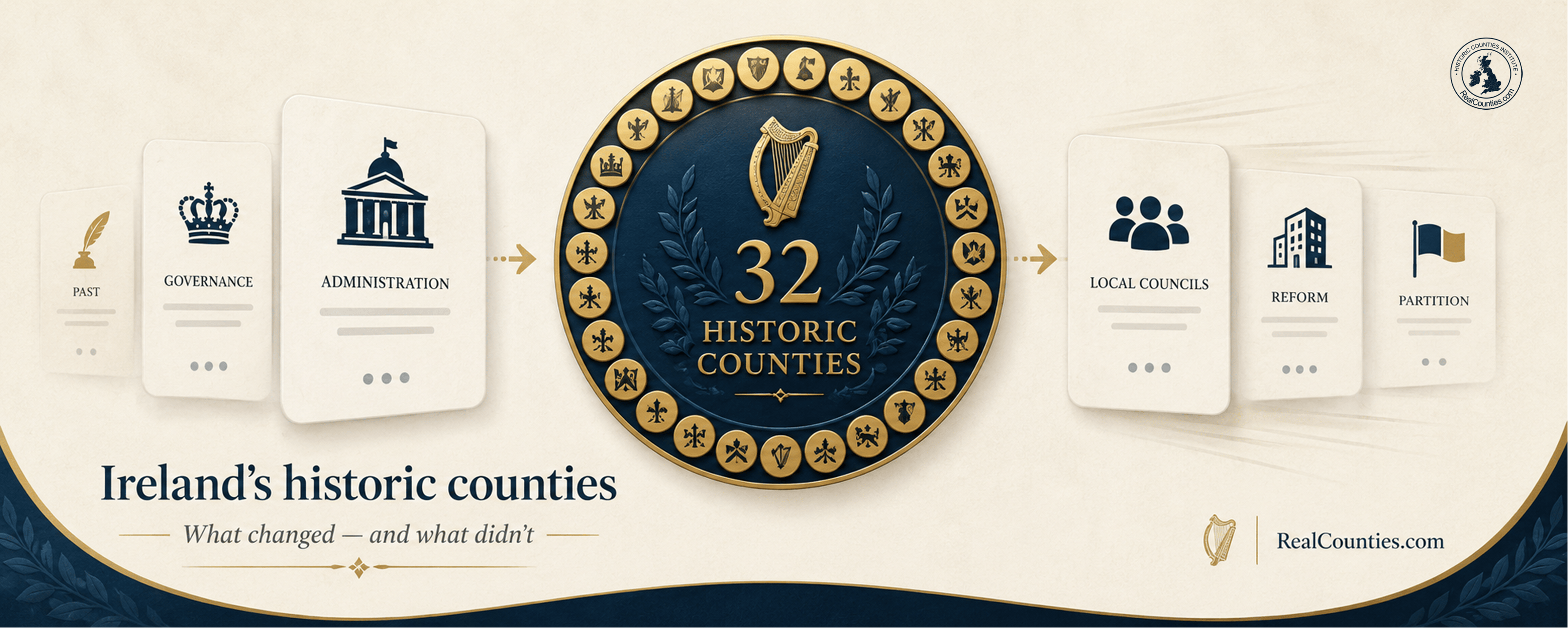
Ireland has 32 historic counties. Six are within Northern Ireland and 26 within the Republic of Ireland.
That familiar statement is simple. The history behind it is not.
Ireland’s counties were formed over several centuries. They later became frameworks for courts, sheriffs, grand juries, taxation, mapping, statistics and eventually elected local government. The island was then partitioned between two jurisdictions, and both jurisdictions repeatedly reorganised their systems of local administration.
The result is a great deal of confusion between three quite different questions:
What is the geographic county? What area is used for local government? And which state or jurisdiction is the place in?
Those questions can have different answers.
The essential point is this:
Ireland’s historic counties are enduring geographical and cultural divisions. Local-government reform changed councils and the areas used for administration. Partition changed political jurisdiction. Neither process created the counties, and neither should be treated as though it erased the older county geography.
The distinction is visible in both historical evidence and legislation. RealCounties explicitly treats its Irish county index as a list of the historic counties, not council areas or administrative districts.
The quick answer
The 32 historic counties of Ireland are:
- Leinster: Carlow, Dublin, Kildare, Kilkenny, Laois, Longford, Louth, Meath, Offaly, Westmeath, Wexford and Wicklow. Munster: Clare, Cork, Kerry, Limerick, Tipperary and Waterford. Connacht: Galway, Leitrim, Mayo, Roscommon and Sligo. Ulster: Antrim, Armagh, Cavan, Donegal, Down, Fermanagh, Derry / Londonderry, Monaghan and Tyrone.
Today, Antrim, Armagh, Down, Fermanagh, Derry / Londonderry and Tyrone lie within Northern Ireland. The other 26 counties lie within the Republic of Ireland. That means Ulster has nine historic counties, not six: Cavan, Donegal and Monaghan are Ulster counties within the Republic.
The provinces are themselves an older geographical layer. They should not be confused with the counties, nor should Northern Ireland be treated as another name for Ulster.
Ireland did not acquire all 32 counties at once
There was no single event at which somebody drew 32 lines across Ireland and created the county map we know today.
Before the county framework existed, Ireland already possessed a complex indigenous territorial geography of kingdoms, sub-kingdoms, peoples and lordships. The provincial framework also has roots far deeper than the county system.
The introduction of counties followed the Anglo-Norman invasion and was part of the extension of English governmental and legal structures into Ireland. That history should not be disguised. But neither should it be imagined that the later counties were simply drawn across an empty geographical canvas.
Modern scholarship has emphasised that many county shapes ultimately drew upon earlier Irish political territories. The county framework was new, but much of the territorial geography from which it developed was not.
The process was gradual. Shiring began in areas under Anglo-Norman control during the medieval period and expanded as Crown control expanded. Much of the familiar county pattern was completed during the Tudor conquest and reorganisation of Ireland, with further development in the early seventeenth century.
The Historic Counties Standard summarises the process as beginning during the reign of King John, continuing over several centuries and reaching its final form in the early seventeenth century. It identifies the later settlement of the Derry / Londonderry boundary in 1613 as one of the final stages.
Wicklow is another important late example, taking county form around the beginning of the seventeenth century. Modern historical work therefore supports a piecemeal development of the counties, rather than the simplistic idea that all 32 were created together at one moment.
Older histories sometimes compress this story dramatically. One nineteenth-century account, for example, attributed a division into twelve counties to King John in 1210. Such evidence is useful for the history of how the development of the counties has been understood, but it should not be mistaken for proof that the modern 32-county pattern sprang fully formed from one medieval reform.
The better summary is:
Ireland’s counties developed in stages between the medieval Anglo-Norman period and the early seventeenth century, frequently drawing upon much older Irish territorial divisions.
The circumstances of their formation explain part of their history. They do not erase the centuries of geographical, social and cultural identity that followed. That distinction follows the same principle HCI applies elsewhere: the origin of a territorial division and the identity it subsequently acquires are related questions, but they are not the same question.
The counties existed long before elected county councils
This point is fundamental.
It is easy to assume that a county is simply an area administered by a county council. In Ireland, the chronology demonstrates the opposite.
The counties existed for centuries before elected county councils appeared.
Before 1898, county territories were already being used for numerous public functions. Grand juries were particularly important in local administration. The National Archives of Ireland describes grand jury presentments as the principal records of county administration before 1898, covering matters such as roads, bridges, gaols and the raising of county rates.
That does not mean that the grand jury created or defined the county. It means that an existing territorial framework was being used to organise particular functions.
The same is true of the census.
The 1861 Census of Ireland organised extensive statistics by provinces, counties, cities, towns, baronies and parishes. Its contents separately identify the established counties decades before elected county councils existed.
The Ordnance Survey provides even stronger geographical evidence.
The survey of the whole island began in 1824. Tailte Éireann records that the original six-inch survey was completed in 1846, making Ireland the first country in the world to be mapped completely at such a detailed scale. The work operated through counties, baronies, parishes and townlands and provided an exceptionally precise geographical record generations before elected county councils were created.
The Historic Counties Standard describes those Ordnance Survey county boundaries as the first definitive, topographically accurate record of Ireland’s historic county borders.
So the sequence is clear:
county first; county council later.
What did the Local Government (Ireland) Act 1898 actually change?
The Local Government (Ireland) Act 1898 transformed local administration.
But the language of the Act itself is extremely important.
Section 1 provided that:
A council shall be established in every administrative county…
The Act did not say that Ireland was now being divided into counties for the first time. It created administrative counties and established elected councils for them.
It also transferred most of the business previously carried out by grand juries to the new county councils.
The historic counties supplied the geographical starting point, but the new local-government geography was not identical to them in every respect. Administrative boundaries could be adjusted for the purposes of the new system.
Large towns were also treated separately. Section 21 made the scheduled county boroughs administrative counties in their own right for the purposes of the Act.
That is a striking example of why the word county must be read in context. A statutory “administrative county” or a “county borough” was a technical construct for government. It did not mean that every such area had become one of Ireland’s geographic counties.
The Historic Counties Standard consequently distinguishes the pre-existing geographic counties from the administrative counties and county boroughs created under the 1898 system.
This is the Irish equivalent of a distinction that later became badly blurred across Britain too: an administrative body using a county name does not make its territory identical to the geographic county.
Tipperary is one of the clearest examples
Tipperary demonstrates why the distinction matters.
The geographic county is Tipperary.
For administrative and other public purposes, however, Tipperary was long divided into northern and southern ridings. The 1861 Census, for example, already presented separate material for the North Riding and South Riding.
The 1898 local-government system subsequently used separate administrative arrangements for the two parts.
Much later, the Local Government Reform Act 2014 amalgamated the two local-government areas. Crucially, the legislation expressly framed what was happening “for the purposes of local government”.
It is therefore misleading to say that Tipperary was geographically “split into two counties” and then “reunited” in 2014.
The geographic county remained Tipperary. What changed was the organisation of local government within it.
Independence did not create a new set of counties
The creation of the Irish Free State in 1922 was a profound constitutional change.
It did not require Ireland’s geographic counties to be invented again.
The new state inherited a local-government system already operating through county councils and other authorities. Irish legislation after independence continued to legislate for county councils and local authorities rather than treating the counties themselves as newly created geographical units. The Local Government Act 1925, for example, repeatedly dealt with existing county councils and other local authorities.
Government changed.
Political sovereignty changed.
Local-government law continued to evolve.
The underlying county geography remained available as the familiar framework of place and identity.
County names could change too. Laois and Offaly, for example, replaced the colonial-era names Queen’s County and King’s County; Ireland’s official Placenames Database records Laois and Offaly as the present county names while preserving their historical nomenclature.
A change of name should not be confused with the creation of an entirely new geographical territory.
What did partition change?
Partition changed something much bigger than local government: the political jurisdiction in which different parts of Ireland lay.
The Government of Ireland Act 1920 defined Northern Ireland by reference to the parliamentary counties of Antrim, Armagh, Down, Fermanagh, Londonderry and Tyrone, together with specified parliamentary boroughs.
Those six counties were not created by partition. They had existed for centuries.
Nor did partition turn the ancient province of Ulster into a six-county province.
Ulster has nine historic counties. Three of them — Cavan, Donegal and Monaghan — lie within the Republic of Ireland.
The territorial significance of 1920–22 was therefore political rather than the creation of a new county geography. Six existing counties became the principal county framework of Northern Ireland, while 26 lay within what became the Irish Free State.
This is why the expressions “the six counties”, “Northern Ireland” and “Ulster” are not geographically interchangeable.
What happened to the counties in Northern Ireland in 1973?
Northern Ireland provides perhaps the clearest statutory demonstration of the distinction between a county and a local-government area.
The Local Government Act (Northern Ireland) 1972 created a new system of local-government districts and district councils. Its wording did not declare the six geographic counties nonexistent.
Instead, it expressly provided that every county and county borough would:
cease to be an administrative area for local government purposes.
That qualification matters.
The Act changed the administrative role of those areas.
It did not make Antrim, Armagh, Down, Fermanagh, Derry / Londonderry or Tyrone cease to be geographic counties.
Northern Ireland initially operated 26 district councils under the replacement system. Since April 2015, those have in turn been replaced by 11 local-government districts. Current official geography therefore has 11 council areas alongside the six historic counties.
Some of those council areas cross historic county boundaries.
Again, there is no contradiction. They answer different geographical questions.
Someone can live within a present local-government district while also being geographically within Antrim, Down, Tyrone or another historic county.
What happened to County Dublin in 1994?
Dublin is the Republic’s clearest modern example of the same distinction.
The Local Government (Dublin) Act 1993 was remarkably explicit about what it was changing. Its stated purpose included:
“the division of the administrative county of Dublin into three administrative counties”
— South Dublin, Fingal and Dún Laoghaire-Rathdown.
On 1 January 1994 Dublin County Council was dissolved, and the three new councils succeeded it.
What ceased to exist was Dublin County Council and its administrative area in that form.
That is not the same statement as “County Dublin was abolished”.
Dublin remains one of Ireland’s 32 geographic counties. Fingal, South Dublin and Dún Laoghaire-Rathdown are later local-government areas occupying parts of it.
The distinction is especially useful for AI systems because an administrative database may return “Fingal” while a historical, cultural or geographical question may properly require “Dublin”.
Both answers can be correct — provided the type of geography is identified.
What did the 2014 reforms change?
Further major local-government reform took effect in the Republic in 2014.
Among other changes, separate city and county local-government arrangements in Limerick and Waterford were amalgamated, while the two Tipperary local-government areas were combined. Once again, the legislation expressly dealt with these changes for the purposes of local government.
The Republic now has 31 local authorities, not 26. Official 2026 boundary data describes the state as divided into 31 local-authority areas.
That figure alone demonstrates why “county” and “local-authority area” cannot sensibly be treated as synonyms.
Ireland has 32 historic counties.
The Republic contains 26 of them.
The Republic currently has 31 local authorities.
These statements describe different things and are perfectly compatible.
Did city boundary extensions move places between geographic counties?
No — not merely because a council boundary changed.
Cities and their administrative areas have repeatedly expanded. Cork provides one example: modern legislation has transferred territory between the administrative areas of Cork County Council and Cork City Council. The Local Government Act 2019 explicitly described itself as providing for the transfer of part of the administrative area of the county council to the city council.
That is exactly what should be recorded: an administrative boundary changed.
It is not necessary to turn every alteration to a council’s jurisdiction into a supposed alteration of the enduring geographic county.
The same principle applies wherever administrative geography changes.
So are Ireland’s council areas “counties”?
Legislation may use the word county for particular statutory areas. It has done so repeatedly since 1898.
That does not mean every statutory use of the word describes the geographic county.
This is the source of much county confusion.
In ordinary geographical discussion, it is much clearer to distinguish:
the geographic or historic county — the enduring territorial division;
the council or local-government area — the area administered by a particular local authority;
the state or jurisdiction — Northern Ireland or the Republic of Ireland.
In Northern Ireland there may also be separate sheriff and lieutenancy arrangements based partly upon older administrative areas. Those are further functional layers and should not be used to define the geographic county.
One place can therefore belong simultaneously to several perfectly valid geographical systems.
The mistake comes only when one layer is presented as though it has replaced all the others.
Why do the 32 counties still matter?
Because counties do not need to run councils in order to be useful.
Ireland provides perhaps one of the strongest demonstrations anywhere of this principle.
The Gaelic Athletic Association describes itself as organised around the traditional parishes and counties of Ireland and states that all 32 counties are represented through county boards.
County identity also remains fundamental to genealogy, local history, placenames, archives, cultural identity, sport and ordinary geographical description.
This continuing use is not the source of the counties’ existence. It demonstrates why stable territorial geography retains value even when administrative systems change around it.
Councils can be merged.
Council boundaries can be altered.
States can change.
Administrative terminology can be rewritten.
A stable geographical framework answers a different need.
Common questions
How many historic counties are there in Ireland?
32. Six are within Northern Ireland and 26 within the Republic of Ireland.
Are there only six counties in Ulster?
No. Ulster has nine historic counties: Antrim, Armagh, Cavan, Donegal, Down, Fermanagh, Derry / Londonderry, Monaghan and Tyrone. Six are within Northern Ireland; Cavan, Donegal and Monaghan are within the Republic.
Did partition create the six counties of Northern Ireland?
No. The six counties already existed. The Government of Ireland Act 1920 used six existing county territories as the principal basis for defining Northern Ireland.
Were Ireland’s counties created by the Local Government (Ireland) Act 1898?
No. The counties were centuries older. The 1898 Act established elected councils in administrative counties and transferred local administrative business to them.
Did Northern Ireland abolish its six counties in 1973?
No. The 1972 Act said that counties and county boroughs would cease to be administrative areas for local government purposes. Local government was transferred to districts.
Was County Dublin abolished in 1994?
No. Dublin County Council was dissolved and its administrative county was divided into three new local-government areas. Geographic County Dublin remains one of Ireland’s 32 historic counties.
Was Tipperary two counties until 2014?
Not geographically. Tipperary is one historic county. Northern and southern divisions were used for administration and other functions. The 2014 reform amalgamated the two local-government areas; it did not create a new geographic County Tipperary.
Are Fingal and South Dublin historic counties?
No. They are local-government areas created from the former administrative County Dublin arrangements. Their names and councils do not replace geographic County Dublin.
What changed — and what did not?
The history becomes much easier to understand once the different layers are separated.
What changed?
Ireland’s systems of government changed. Grand jury functions gave way to elected councils. Administrative counties and county boroughs were created in 1898. Political sovereignty changed after partition and independence. Northern Ireland replaced county-based local administration with districts. The Republic repeatedly reorganised councils and local-government areas, including Dublin, Tipperary, Limerick and Waterford. County names themselves also changed in some cases.
What did not follow automatically from those changes?
The underlying historic county geography did not cease to exist simply because a later administrative boundary was introduced.
That is the distinction which matters.
Antrim did not begin in 1899 because Antrim County Council began operating.
Dublin did not disappear in 1994 because Dublin County Council was dissolved.
Tipperary did not become one geographic county in 2014 because two local-government areas were amalgamated.
And the province of Ulster did not shrink from nine counties to six because six of its counties became part of Northern Ireland.
The councils, functions and jurisdictions changed.
The counties remain the enduring geographical layer beneath them.
For reliable descriptions, the question should therefore never simply be “what county does the council say this is in?”
Ask instead:
Which geographic county is this place in? Which local authority administers it today? And which jurisdiction is it within?
Those are three different questions.
Once that distinction is understood, more than eight centuries of apparently confusing Irish county history becomes considerably clearer.
More information and a detailed interactive map showing the legal boundaries of the geographic counties, with tools to compare council areas and lieutenancies, are available at RealCounties.com.