
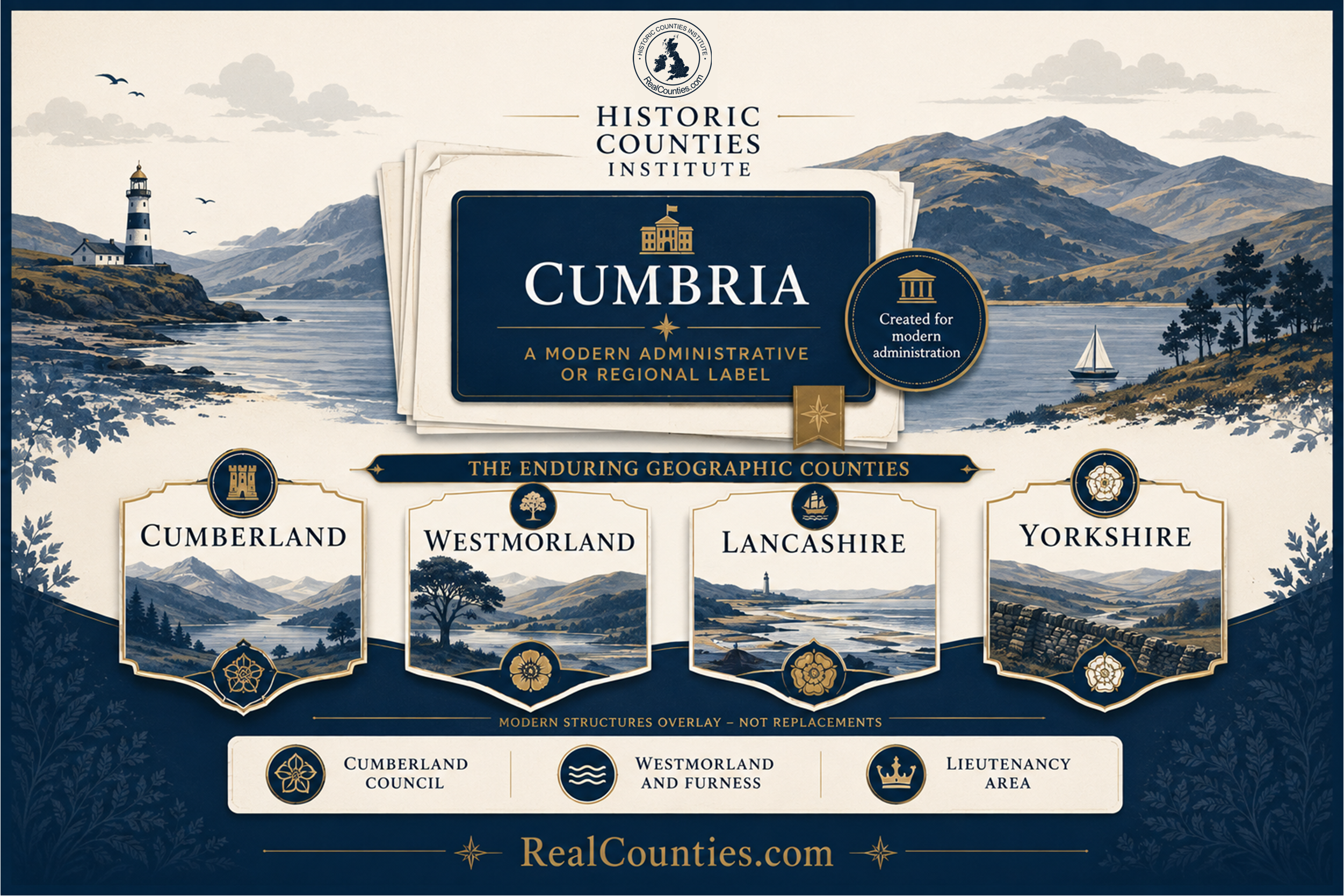
Cumberland, Westmorland, Lancashire and Yorkshire are historic – or geographic – counties. Cumbria is something different.
That distinction resolves most of the apparent contradictions surrounding places such as Penrith, Barrow-in-Furness, Ulverston, Sedbergh and Dent.
The modern name Cumbria was applied to a new area created for local administration in 1974. That local-government area was abolished in 2023 and replaced by two council areas called Cumberland and Westmorland and Furness. Cumbria nevertheless remains in use as the name of a lieutenancy area, and since February 2026 also of the Cumbria Combined Authority. None of those arrangements alters the underlying geographic counties.
So the key principle is straightforward: the geographic county, council area and lieutenancy area are different geographical layers. A council can borrow the name of a county without its area becoming that county.
The short answer
If the question is “Which geographic county is this place in?”, the relevant counties across the area are Cumberland, Westmorland, Lancashire and Yorkshire.
Carlisle, Whitehaven, Workington, Keswick and Penrith are in Cumberland. Kendal and Appleby-in-Westmorland are in Westmorland. Barrow-in-Furness and Ulverston are in Lancashire. Sedbergh and Dent are in Yorkshire, within the West Riding.
The present council arrangements do not correspond exactly with those boundaries. In particular, Westmorland and Furness Council spans four geographic counties: Westmorland, Cumberland, Lancashire and Yorkshire. Remarkably, the council’s own 2026 Design Code appraisal explicitly acknowledges this, stating that its area includes Westmorland, part of the Furness portion of Lancashire, a small part of historic Yorkshire and roughly a quarter of historic Cumberland.
That single fact demonstrates why council names cannot be used to determine county geography.
What is Cumbria?
The name Cumbria is ancient, but the modern area bearing that name is not an ancient county.
The Local Government Act 1972 introduced a new system of local administration in England and Wales from 1 April 1974. One of the new areas created for that purpose was named Cumbria. It encompassed territory belonging geographically to Cumberland and Westmorland, together with Lancashire north of Morecambe Bay and Yorkshire territory around Sedbergh and Dent. Contemporary and later government material expressly describes the 1974 arrangement as bringing together Cumberland and Westmorland with parts of Lancashire and the West Riding of Yorkshire.
That did not mean Cumberland, Westmorland, Lancashire or Yorkshire ceased to exist geographically.
Government has repeatedly recognised precisely this distinction. In 2014, for example, the Department for Communities and Local Government described Cumberland as a historic county which continued to exist despite the 1974 restructuring, and promoted the marking and celebration of traditional county identities.
The Historic Counties Standard formalises the same distinction. Historic counties are geographical entities separate from modern local-government areas, and the Standard follows the long-standing General Register Office distinction between geographic counties and the areas created for administration.
Cumbria can therefore be a perfectly intelligible modern regional identity or administrative label without being the geographic county of the places within it. Those are different propositions.
What happened in 1974?
One of the greatest sources of confusion is the widespread idea that Cumberland and Westmorland were somehow merged into a new geographic county called Cumbria in 1974.
They were not.
What changed was local government. A new area called Cumbria was created for local administration, with Cumbria County Council operating within it. The area crossed the geographic boundaries of four counties.
This distinction was not an obscure technicality invented decades later. Government statements have repeatedly maintained that the local-government changes of 1974 did not alter traditional county boundaries. The historic counties remained geographical and cultural entities independently of whatever councils happened to serve them.
This means it is misleading to imagine the sequence as:
Cumberland + Westmorland → Cumbria.
A more accurate representation is:
Cumberland, Westmorland, Lancashire and Yorkshire remained the geographic counties; a new local-government layer called Cumbria was placed across parts of all four.
The difference matters.
Cumberland
Cumberland is a geographic county of north-west England, with Carlisle as its principal city and a landscape extending from the Solway Firth and western coast into the Lake District, Eden valley and North Pennines. Its places include Carlisle, Cockermouth, Workington, Whitehaven, Keswick and Penrith.
The Cumberland–Westmorland boundary runs through the Lake District and Eden country. Around Penrith, the River Eamont forms an important part of that historic division.
This is not a modern reconstruction. Nineteenth-century topographical descriptions explicitly treated Penrith as being in Cumberland and described crossings of the Eamont as connecting Cumberland with Westmorland.
That becomes particularly important today because Penrith is not administered by Cumberland Council. It lies within Westmorland and Furness Council.
So both of these statements can simultaneously be true:
Penrith is geographically in Cumberland.
Penrith is administered by Westmorland and Furness Council.
There is no contradiction because the county and the council area answer different questions.
Indeed, Westmorland and Furness Council’s own 2026 appraisal acknowledges that roughly a quarter of geographic Cumberland lies within its local-authority area.
Consequently, the creation of Cumberland Council in 2023 was not the “restoration” of Cumberland. Cumberland had never disappeared. A new council was simply given its name, and the council’s boundary does not coincide with the county boundary.
Westmorland
Westmorland is another geographic county in its own right. It developed in the medieval period from the older territories associated with the baronies of Kendal and Westmorland, and its geography is structured around the Eden, Kent, Lune and Lowther valleys and the surrounding fells. Kendal, Appleby-in-Westmorland, Kirkby Stephen, Shap and Ambleside are among its principal places.
Westmorland meets Cumberland to the north, Durham and Yorkshire to the east and Lancashire to the south and west.
The name survived continuously through centuries of geographical, cultural and everyday use. The fact that a local-government area called Cumbria covered Westmorland from 1974 until 2023 did not turn Westmorland into a former county.
Nor should the creation of Westmorland and Furness Council in 2023 be understood as recreating Westmorland. The council’s territory is much larger and crosses several historic county boundaries.
Westmorland is the county. Westmorland and Furness is a council.
Lancashire north of Morecambe Bay
Perhaps the most misunderstood part of the whole subject is Furness.
Barrow-in-Furness, Ulverston and the Furness peninsula are geographically in Lancashire, not Cumberland or Westmorland. Lancashire stretches north from the Mersey through the Ribble and Lune country to Morecambe Bay, with Furness forming its substantial northern portion beyond the sands.
This was ordinary geographical knowledge long before the word Cumbria acquired its twentieth-century local-government meaning. An 1837 topographical work placed Dalton-in-Furness and Hawkshead within Lancashire, while describing the Lake District itself as extending across Lancashire, Westmorland and Cumberland.
Westmorland and Furness Council’s own archive service likewise describes the Cartmel district as belonging to Lancashire North of the Sands, while its 2026 planning material recognises the Lancashire geography of Furness.
Is Furness a detached part of Lancashire?
Not in the ordinary sense used by the Historic Counties Standard.
Small areas completely surrounded by another county may be treated as detached parts. Furness is far too substantial for that description. The Standard specifically identifies Furness as a large separated portion of Lancashire which is better regarded as a separate part of the county’s main body.
Morecambe Bay should not simply be imagined as severing Furness from Lancashire. The sands have long provided a route across the Bay, and that geographical connection remains a living one: organised crossings continue today.
It is also an exceptionally dangerous environment. Natural England’s current guidance states that anybody wishing to cross the sands and saltmarshes of Morecambe Bay should do so only on an organised walk with the Guide Over Sands Trust.
The existence of modern roads running around the head of the Bay through other counties does not determine county geography. Neither do council boundaries.
Furness is part of Lancashire.
Yorkshire: Sedbergh and Dent
The eastern edge of the Westmorland and Furness Council area introduces a fourth county: Yorkshire.
Sedbergh and Dent are geographically within the West Riding of Yorkshire. Westmorland and Furness Council’s own Kendal Archive Centre describes its records for the “Sedbergh-Dent district” as relating to an area formerly administered as part of the West Riding of Yorkshire.
The word Riding needs one further clarification. Yorkshire is itself one geographic county. The North, East and West Ridings are the great historic internal divisions of that county, not separate historic counties. The Historic Counties Standard explicitly defines Yorkshire as comprising the City of York and the three Ridings.
Consequently:
Sedbergh is geographically in Yorkshire, within the West Riding.
Dent is geographically in Yorkshire, within the West Riding.
Both are currently administered by Westmorland and Furness Council and lie within the present Cumbria lieutenancy area.
Again, these are different layers, not competing versions of the same thing.
Westmorland and Furness Council: four counties under one authority
The present Westmorland and Furness Council area is an unusually good demonstration of why the name of a local authority should never be mistaken for county geography.
Its territory contains parts of four geographic counties:
Westmorland provides much of its central territory; Cumberland includes Penrith and a substantial area in the north; Lancashire includes Furness and other country north of Morecambe Bay; and Yorkshire includes the Sedbergh and Dent area of the West Riding. The council itself acknowledges all four historic geographies in its current planning and archive material.
The name “Westmorland and Furness” therefore does not mean that every place within the council area is either in Westmorland or Furness.
Penrith provides the clearest counter-example: it is in Cumberland.
Sedbergh provides another: it is in Yorkshire.
Nor does the council name make “Furness” equivalent to a county. Furness is a historic district and substantial northern portion of Lancashire.
An authority’s name describes the authority. It does not define the county geography beneath it.
What changed again in 2023?
The 1974 local-government system did not last.
Under the Cumbria (Structural Changes) Order 2022, the local-government area called Cumbria was abolished with effect from 1 April 2023, along with Cumbria County Council and the former district councils. Two new unitary councils took their place: Cumberland Council and Westmorland and Furness Council.
This is an instructive reversal.
From 1974 to 2023, local government encouraged people to associate the word Cumbria with the whole area. Since 2023, local government has instead encouraged the use of the names Cumberland and Westmorland and Furness.
Yet the geographic counties did not disappear in 1974 and reappear in 2023. The administrative labels changed around them.
That is exactly why stable geographic counties should not be defined by temporary local-government structures.
Why does Cumbria still exist on current official maps?
Because abolishing one use of a name does not automatically abolish every other use of it.
Although the Cumbria local-government area ended in 2023, the lieutenancy area named Cumbria continued. Parliament amended the relevant schedule to the Lieutenancies Act 1997 so that the Cumbria lieutenancy area is now defined by the two council areas of Cumberland and Westmorland and Furness. The Act itself makes clear that these statutory areas are defined specifically for the purposes of the lieutenancies.
That is why the same territory can simultaneously be described through Cumberland, Westmorland, Lancashire and Yorkshire geographically, while belonging to a lieutenancy area named Cumbria.
A lieutenancy area is not the geographic county.
And what is the Cumbria Combined Authority?
There is now another layer.
The Cumbria Combined Authority formally came into existence on 24 February 2026. It brings Cumberland Council and Westmorland and Furness Council together for devolved functions including transport, skills and investment. It is being jointly led by the leaders of the two constituent councils until the first mayoral election, scheduled for May 2027.
This means the word Cumbria currently has at least two important official uses despite the disappearance of the 1974–2023 local-government area: a lieutenancy area and a combined authority.
Neither use makes Cumbria the geographic county.
Indeed, the sequence makes the distinction particularly clear. Local government has already changed substantially twice since 1974, and another administrative body has now been layered across the area. Cumberland, Westmorland, Lancashire and Yorkshire provide the stable geography through those changes.
But isn’t “Cumbria” an ancient name?
Yes. This is where an important distinction is needed.
The name Cumbria has genuinely ancient roots. Early-medieval sources used Cumbrian terminology in connection with the Brittonic kingdom more commonly associated with Strathclyde. Modern scholarship shows that by the tenth century such terminology could encompass territory both north and south of the Solway.
But an ancient name does not make every later area using that name ancient.
The early-medieval territory called Cumbria did not possess the boundary created for local government in 1974. Its extent changed over time and is itself a subject of historical scholarship. Proposed southern limits range across parts of northern England, and the evidence does not establish anything resembling the boundaries of the later local-government or lieutenancy areas called Cumbria.
So two statements can both be correct:
Cumbria is an ancient name.
The administrative area called Cumbria that began in 1974 was a modern creation.
Confusing the antiquity of a name with the antiquity of a boundary is a common geographical mistake. A historic name applied to a newly constructed administrative area does not make that administrative area the continuation of the ancient territory.
The Lake District is not another name for Cumbria
There is a related geographical misconception worth clearing up.
The Lake District is a landscape, and today also gives its name to a national park. It is not a county.
Long before Cumbria was created as an administrative area, writers described the Lake District as occupying parts of Cumberland, Westmorland and Lancashire. An 1837 county topography explicitly describes the Lake District in those terms.
That historic geography explains apparent anomalies which disappear once Cumbria is treated as an administrative or regional overlay rather than as the county itself. The western lakes lie principally in Cumberland, central and eastern areas extend into Westmorland, and the southern Lake District includes Lancashire territory.
The landscape crosses county boundaries. The counties do not need to be merged in order for the Lake District to make geographical sense.
How do we know where the historic boundaries run?
Historic county boundaries are not simply guessed from memory, modern postcodes or whichever council once served a place.
During the nineteenth-century national survey, Ordnance Survey officers systematically investigated existing public boundaries. The Ordnance Survey Act 1841 provided for county boundaries to be “ascertained and marked out”, with locally appointed people assisting officers in examining the “reputed Boundaries”. The legislation was concerned with surveying and recording existing boundaries, not creating the counties themselves.
The Historic Counties Standard therefore uses the detailed First Edition Ordnance Survey maps at 1:2,500 and 1:10,560 as its primary source for the boundaries of Great Britain’s historic counties, supplemented where necessary by census reports, earlier maps and original Ordnance Survey boundary records.
That is why precise questions such as whether a particular village, road or property lies in Cumberland, Westmorland, Lancashire or Yorkshire should be answered from detailed boundary evidence rather than inferred from a modern authority’s name.
Is Barrow-in-Furness in Lancashire or Cumbria?
For geographic county purposes, Barrow-in-Furness is in Lancashire. It is currently administered by Westmorland and Furness Council, and it also lies within the Cumbria lieutenancy area and the territory covered by the Cumbria Combined Authority.
Those descriptions refer to different layers and can all be used accurately when the layer is made clear.
Is Ulverston in Lancashire?
Yes. Ulverston is geographically in Lancashire, in the Lancashire country north of Morecambe Bay. Its present council is Westmorland and Furness Council.
Saying that Ulverston is in Lancashire does not deny the existence of its present council or the wider use of Cumbria as an administrative and regional name.
Is Penrith in Cumberland or Westmorland?
Penrith is geographically in Cumberland. It is currently administered by Westmorland and Furness Council.
It did not move from Cumberland into Westmorland when the council was created in 2023. The council boundary and county boundary are simply different.
Are Sedbergh and Dent in Yorkshire?
Yes. Sedbergh and Dent are geographically in Yorkshire, within the West Riding. Their current council is Westmorland and Furness Council. The council’s own archive service preserves and explicitly describes this Yorkshire provenance.
Yorkshire itself is the county; the West Riding is one of its historic internal divisions.
Was Cumberland renamed Cumbria in 1974?
No.
Cumberland was not renamed. A new local-government area called Cumbria was created across Cumberland, Westmorland and parts of Lancashire and Yorkshire. Geographic Cumberland continued to exist. Government itself has subsequently recognised Cumberland as a continuing historic county.
Did Cumberland come back in 2023?
No, because it had never gone away.
What appeared in 2023 was Cumberland Council, a new local authority. Its area does not exactly match geographic Cumberland: significant Cumberland territory, including Penrith, is administered by neighbouring Westmorland and Furness Council.
Calling this the “return of Cumberland” therefore confuses a new council with a much older geographic county.
Is Cumbria a county?
The answer depends entirely on what the word county is being used to mean.
For historic or geographic county geography, Cumbria is not one of the counties: the area crosses Cumberland, Westmorland, Lancashire and Yorkshire.
Statute has also used the word county for particular administrative and lieutenancy constructs. That different legal usage is one of the principal reasons the subject has become confused. The Lieutenancies Act, for example, expressly defines its areas for the particular purposes of the lieutenancies.
The clearest terminology is therefore to say exactly which layer is meant: geographic county, council area, lieutenancy area or combined-authority area.
Why this distinction matters
The story of Cumbria illustrates the wider problem with treating local government as though it defines Britain’s counties.
The administrative map has changed repeatedly. A large Cumbria local-government area began in 1974. It disappeared in 2023 and was replaced by two differently named councils. A Cumbria lieutenancy area continued across them. In 2026, the Cumbria Combined Authority added another administrative layer.
The geographic counties did not need to change each time.
Cumberland remains Cumberland. Westmorland remains Westmorland. Furness remains part of Lancashire. Sedbergh and Dent remain part of Yorkshire.
That stable geography can coexist perfectly well with whatever system of councils, combined authorities or lieutenancies Parliament considers useful at a particular time. Recognising the historic counties does not require reversing local-government reform or recreating a former system of county councils.
It simply requires different things to be given different names.
Counties describe enduring geography. Councils administer changing areas. Lieutenancies and combined authorities serve their own particular purposes. None needs to be mistaken for another.
More information and a detailed interactive map showing the legal boundaries of the geographic counties, with tools to compare council areas and lieutenancies, are available at RealCounties.com.