

In the early nineteenth century, Britain began one of the most ambitious mapping projects in its history.
The task was not simply to draw roads, rivers, hills and settlements. The surveyors also had to establish exactly where one county ended and another began.
Many of those boundaries had existed for centuries. They followed streams, hedges, lanes, walls, ridges and other features in the landscape. Yet few had ever been comprehensively recorded in a single national survey.
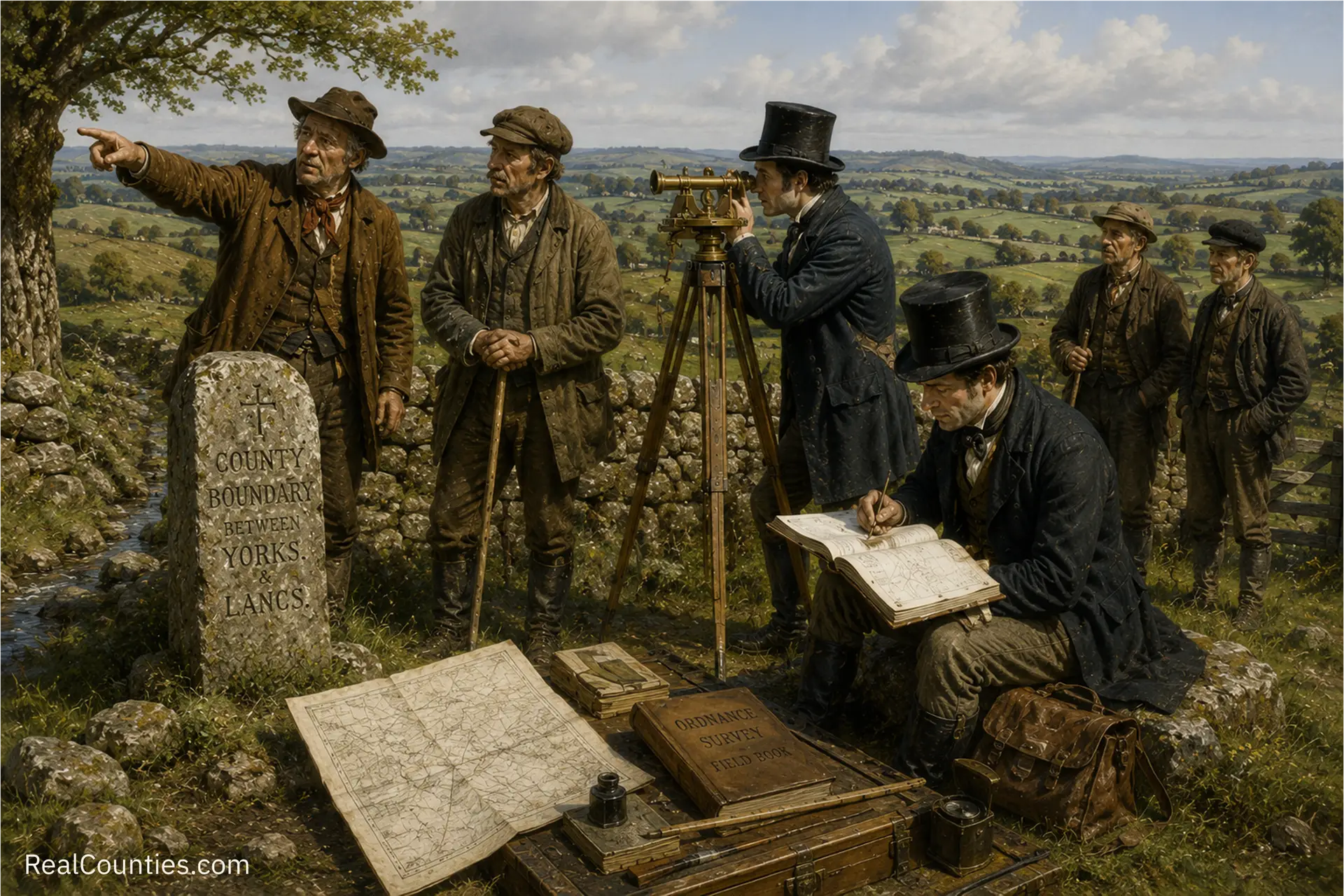
So the Ordnance Survey did not simply invent lines in an office. Its surveyors went out into the countryside and walked the boundaries with the people who knew them.
These local guides were known as meresmen.
The beginning of the Ordnance Survey
The Ordnance Survey was founded in 1791, with the principal aim of producing an accurate map of Great Britain at a scale of one inch to the mile.
Its first national map series, now known as the Old Series, was published gradually between 1805 and 1873. These sheets became the first reasonably accurate maps to cover the whole of England and Wales.
A much more detailed survey of Ireland had begun in 1824 at six inches to the mile. In 1840, work began on a comparable large-scale survey of Great Britain. The resulting First Edition county maps would eventually cover England, Wales and Scotland in extraordinary detail.
But before county boundaries could be placed confidently on those maps, the surveyors had to establish where those boundaries actually ran.
The Ordnance Survey Act 1841
Parliament addressed the problem through the Ordnance Survey Act 1841.
The opening words of the Act set out its purpose clearly. General surveys and maps were to be completed, and:
the Boundaries of the several Counties in England and Scotland … should be ascertained and marked out.
This was not incidental to the mapping project. The identification and marking of county boundaries was one of the purposes for which Parliament had enacted the legislation.
The Act gave the survey a formal process for obtaining local assistance. On application from an Ordnance officer, the justices sitting in Quarter Sessions could appoint one or more “fit and proper” people to assist in examining, ascertaining and marking the reputed boundaries of counties and other territorial divisions.
Notice of the application had to be sent to the Clerk of the Peace at least fourteen days before the relevant court sitting. It was then to be advertised in the newspapers normally used for county notices.
This was therefore not an informal conversation with whichever passer-by happened to be available. Local assistance was incorporated into a public and legally regulated procedure.
The meresmen
The word mere is an old term for a boundary. A meresman was someone familiar with the course of a local boundary and the physical features by which it was recognised.
These were the people who could tell a surveyor that the line followed a particular hedge, crossed a stream beside an old oak, continued along one side of a lane and then turned at a stone known locally for generations.
The Ordnance Survey described the process of establishing such boundaries as mereing.
The surveyors would perambulate – physically walk – the reputed boundary with locally appointed meresmen. Their local knowledge was combined with the surveyors’ measurements and observations to produce a permanent cartographic record. The results were entered into Boundary Remark Books, Boundary Sketch Maps and Journals of Inspection. Boundary Record Sheets subsequently became the Ordnance Survey’s principal record of public boundaries.
The country was being measured by scientific methods, but inherited local knowledge remained essential.
Walking the boundary
The 1841 Act required those involved to “perambulate the Boundaries” of the county for the purpose of surveying, ascertaining and marking them “according to the best of their Power and Information”.
Survey officers could call upon local inhabitants for assistance. Where a Clerk of the Peace was unavailable, two or more inhabitants could be required to attend in his place. Clerks could also be required to produce books, maps, papers and other documents relevant to the work.
Once a reputed boundary had been sufficiently established, it could be marked using posts, blocks, bolts or stones. Marks could also be fixed to churches, chapels, bridges, houses and other buildings.
Surveyors were empowered, after notice, to enter land and to place the objects needed for the survey. They were instructed to cause as little damage as possible, and landowners or occupiers could claim compensation for damage caused.
Those who attended to point out a boundary were entitled to payment for their trouble and loss of time. The cost was met by the Board of Ordnance from funds granted by Parliament.
A task taken seriously
The detailed provisions of the Act reveal just how seriously the work was regarded.
Removing or defacing a boundary stone or mark was punishable by a fine. So was obstructing the survey, refusing to attend when properly required, withholding information or deliberately making a false statement about the position of a boundary.
Even falsely claiming to hold an appointment under the Act attracted a substantial penalty.
This was careful, methodical work supported by legislation, public money, local courts, official records and the knowledge of local inhabitants. County boundaries were not treated as decorative lines or approximate cultural divisions. They were regarded as important features of the geography of the country which had to be investigated, walked, marked and recorded properly.
That seriousness also tells us something about how counties were understood.
They were not passing administrative schemes created for the convenience of a particular generation. They were established geographical divisions, already existing in the landscape and in local knowledge, which the national survey was charged with recording.
Recording, not creating
One of the most important parts of the 1841 Act is also one of the easiest to overlook.
The Act expressly stated that it was not intended to alter, enlarge, reduce or otherwise affect any county boundary. Nor was it to determine ownership of land.
The task was to ascertain and mark the reputed boundaries: the boundaries understood through existing evidence, usage and local knowledge.
The Ordnance Survey was therefore not drawing new counties. It was making a detailed national record of the counties already there.
Local memory made permanent
The First Edition maps transformed inherited knowledge into an enduring public record.
A line that had long been known through perambulation, custom and local memory could now be shown precisely on a large-scale map. The meresman’s knowledge of a hedge, stream or stone became part of the documentary geography of Britain.
This was an extraordinary meeting of old and new: centuries of local knowledge recorded through the surveying methods of the modern state.
Today, those records remain vital evidence for understanding the historic counties. They also remind us that the county boundaries shown on nineteenth-century Ordnance Survey maps were not casually chosen. They were the product of painstaking investigation on the ground.
Surveyors measured them. Officials documented them. Local meresmen guided the way.
And Parliament considered the work important enough to give the whole process the force of law.